GETTING TO THE RANCH
Google has gotten weird with directions to the front (west) gate and isn’t reliable to get there in an efficient way and you need to make the trip in two legs. Here is a better way to ensure you get to the property without being routed to places unknown…
1. First, set a destination to the River Hills Ranch east gate: 31° 2′ 7.0012″ N 97° 57′ 17.2411″ W (https://goo.gl/maps/67wbNJH81y2dVDHh7)
2. Open the gate using the code that will be emailed to you at 9AM on the day of check-in.
3. Enter the east gate and please wait for the automatic gate to close completely before proceeding. Please do not drive away until the gate closes. This take up to 30 seconds. If it doesn’t close – contact Jeremy. This is important for the protection of the animals.
GETTING TO YOUR SUITE ONCE YOU ARE INSIDE THE RANCH
Please do not exceed 30mph – There can be a lot of wildlife along the roads that you may not see until they leap into the road!
Do not use google maps or any other map software inside the ranch. It won’t work properly, you will get lost. Use the directions and, for extra help, the map that at the URL I’m providing below.*
1. Continue on the road leading from the east gate.
2. You will enter a turning circle after about ⅓ mile. Take the second exit out of the turning circle. This means you’ll be continuing straight in the same direction of travel.
3. You are now on High Point Drive. Continue on High Point Drive for .8mi until you reach the end cul-de-sac. You have arrived at Lost Horizon.
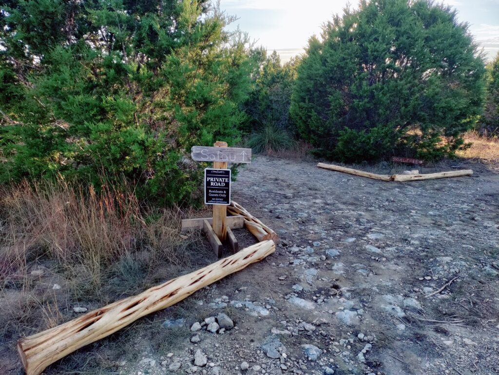
4. There is an arrow sign that says “Satau” and a road into the trees bordered by cedar logs.
If you have a higher clearance vehicle (most stock pickups and SUVs) you may drive the Satau road all the way to the suite. You do not need 4×4 or AWD. Be aware that there are some small stumps and rocks – watch out for them if you decide to drive all the way. If you don’t want to drive it, park and take the foot trail (details below).
Here’s a photo of the sign and road into the trees:
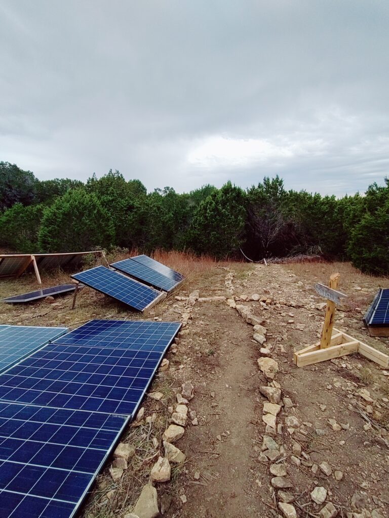
The foot path is about 300ft from the street to the suite. If you decide to take the foot path instead of driving, park in the trees or in the cul-de-sac and then locate the water tanks, shipping container and solar panels – really, you can’t miss them. It’s to your right if you’re facing the sign in the direction in the photo above. Follow the foot path and sign through the solar panels past the water tanks.
Here’s a photo of the footpath sign. Stay left and walk over the dry waterfall.
Follow that trail for about another 250 ft and you will pop out onto a plateau at the back of your suite. You can go in the back or walk around to the front. There is no key needed for either door.
Getting to the River
The ranch’s Lampasas river access point is a beautiful 5 acres wooded area at the south east edge of the ranch. This is not a public access point. It is about 3 miles, one way, from Lost Horizon within the ranch. Pack out anything you bring in – don’t litter – don’t leave a mess. Ground fires are not permitted here. You may bring a portable grill. The drive is usually a great time to see the animals. There are also two picnic tables down there – you can use them – they are first come first serve.
WARNING: You are entirely responsible for yourself and your actions at the community river area, there are no life guards and no residences anywhere near by. There is no one there to help you and mobile coverage is poor down there. Be smart, be prepared, stay aware of your surrounding and your limitations. You will likely be entirely alone. You can check Lampasas River conditions here
You cannot hike on trails all the way to the river. There is no trail directly to it and walking or driving the fence line road or other side rods will have you on other ranch owners private property and trespassing – please don’t do it. You must drive or walk (6 miles round trip) the main ranch roads to get there.
1. Drive back toward the turning circle and this time take the third exit. This means you’re taking a left.
2. You are now on the main ranch road that will take you to the other side of the ranch. Drive about 1.8mi from the turning circle and you will see the west gate (it looks like the east gate) to your right and about 600ft away, look straight ahead and you will see “Cattle Trail” road.
3. Take Cattle Trail all the way to and through the high fence gate at the cow pasture. The high fence gate here is manual and uses a chain-in-notch mechanism to secure it. You need to get out to open/close. Do not leave the gate open and be sure to chain it back correctly.
4. Continue through the cow pasture until you reach the cul-de-sac with the large feed hopper and water cistern. Leave the cows alone please.
5. Look right and you will see a dirt road into the community park. You can drive down in there or park and walk. The land to the right of the dirt road is not part of the community area – please stay out of it.
Do not, under any circumstances, leave the smaller person size gate at the river open. The cows will go down to the river and get lost on the 3500 acre ranch on the other side of the river. This is a really expensive pain in the rear to sort out!
The fences in the community area denote private property boundaries for other ranch owners. Please respect these boundaries – don’t trespass Additionally, the land on the other side of the river is another privately owned cattle ranch – don’t trespass.